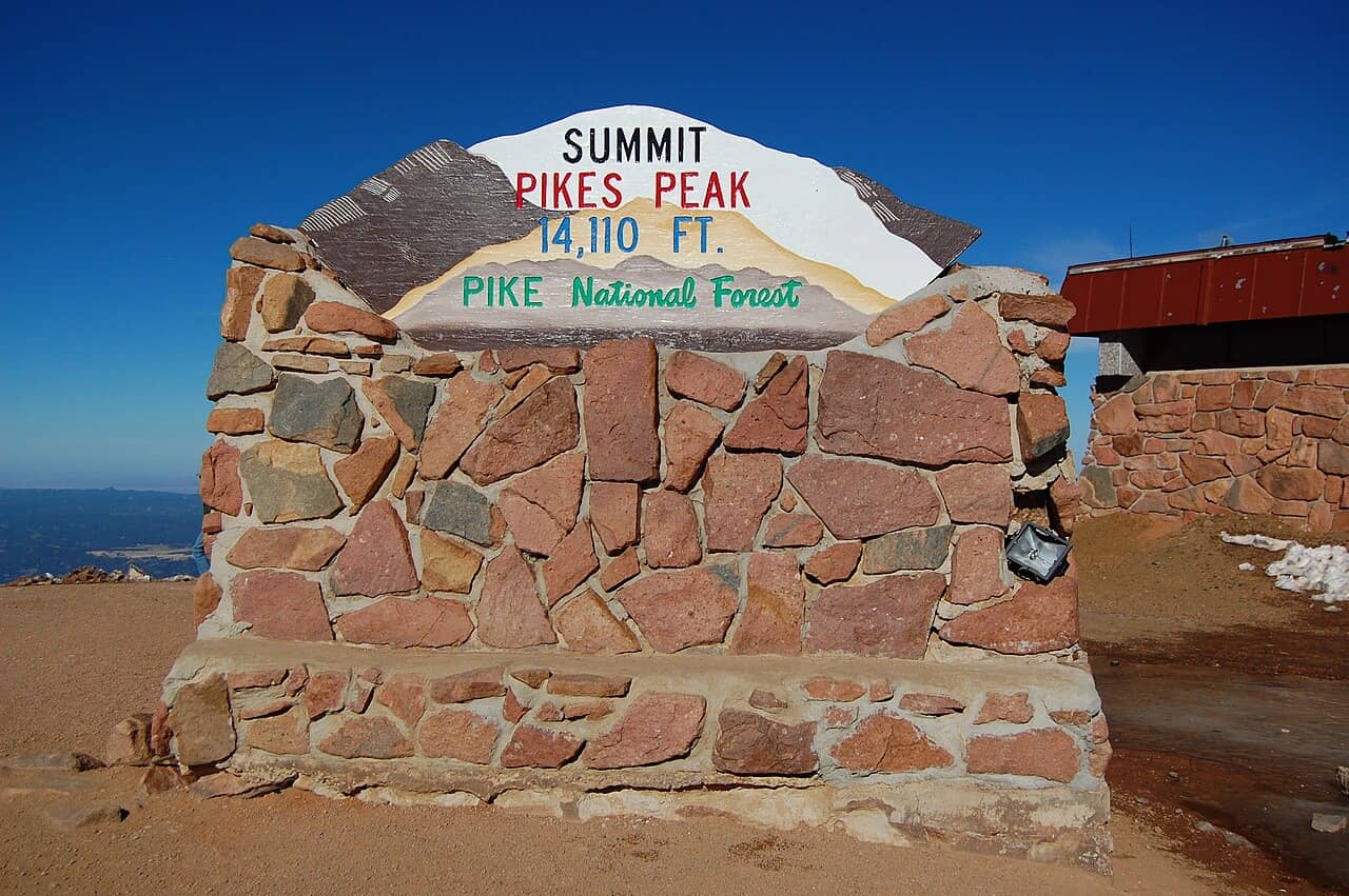
How tall is Pikes Peak?
14,115 feet (4,302 m) above sea level. That is the official figure on the summit sign and the Highway and Cog Railway sites; a 2024 geodesy study puts the summit at 14,107 ft (4,299.83 m) in the new national height system.
| Figure | Height | Where it comes from |
|---|---|---|
| Official today | 14,115.3 ft4,302.36 m | National Geodetic Survey benchmark JK1242 on the summit, NAVD 88. Rounded, it is the 14,115 ft on the sign. |
| 2024 geodesy | 14,107 ft4,299.83 m | Ahlgren, Van Westrum and Shaw, Journal of Geodesy (2024), in the coming NAPGD2022 system. |
| Old datum (superseded) | 14,109.7 ft4,300.63 m | The same benchmark in NGVD 29, the system before 1988. |
Why does Pikes Peak have two elevations?
Because heights depend on the reference surface used for sea level. 14,115 ft is the National Geodetic Survey benchmark in today's official system (NAVD 88); the 2024 study measured the summit for the coming system (NAPGD2022) and got 14,107 ft. Neither number means the mountain moved.
"Sea level" under a mountain is a modelled surface, not water you can measure against. When the US moved from the 1929 system to NAVD 88, the benchmark on Pikes Peak went from 14,109.7 to 14,115.3 ft without a single rock moving: the NGS computed the new figure by shifting the old one (VERTCON). The 2024 study re-measured all of Colorado's fourteeners with satellite positioning and a modern gravity model. It found the summits on average 1.6 m (about 5 ft) lower than published. Only about 0.5 m of that comes from the new reference surface; most comes from how the 19th and 20th century triangulation was calculated. No peak fell below 14,000 ft.
Which to use? Until the new system is adopted, 14,115 ft stays the official number, and it is the one on the summit sign, the Highway, the Cog Railway and the race courses. We use it everywhere else on this site.
Elevation of every stop on the Highway
The city's own milepost elevations, with the air pressure and boiling point at each stop from the standard atmosphere (our calculation, not a measurement).
| Mile | Stop | Elevation | Air pressure | Water boils at |
|---|---|---|---|---|
| 3 | Gateway (toll gate) | 8,540 ft2,603 m | 73% | 196 °F91 °C |
| 6 | Crystal Reservoir and visitor center | 9,160 ft2,792 m | 71% | 195 °F91 °C |
| 7 | Shuttle lot and timed-entry checkpoint | 9,300 ft2,835 m | 71% | 195 °F91 °C |
| 10 | Halfway Picnic Grounds | 9,930 ft3,027 m | 69% | 194 °F90 °C |
| 13 | Glen Cove | 11,440 ft3,487 m | 65% | 191 °F88 °C |
| 16 | Devils Playground | 13,058 ft3,980 m | 61% | 188 °F87 °C |
| 19 | Summit | 14,115 ft4,302 m | 58% | 186 °F86 °C |
How much elevation gain is it to the top of Pikes Peak?
5,575 ft by the Highway from the Gateway, 7,795 ft by the Cog Railway from Manitou Springs, and 7,408 ft net on the Barr Trail from the trailhead (7,390 to 7,800 ft with the dips counted).
| Way up | Starts at | Net gain to the summit | Distance |
|---|---|---|---|
| Pikes Peak Highway | the Gateway toll gate (mile 3), 8,540 ft2,603 m | 5,575 ft1,699 m | 19 mi of road from Cascade; the official site calls it a 38-mile round trip of at least two hours |
| Cog Railway | the depot in Manitou Springs, 6,320 ft1,926 m | 7,795 ft2,376 m | 9 mi of track, about 1 h 10 min up |
| Barr Trail | the Ruxton Avenue trailhead, 6,707 ft2,044 m | 7,408 ft2,258 m | 13 mi one way; published gain 7,390 to 7,800 ft including the dips |
Is Pikes Peak the tallest mountain in Colorado?
No. It ranks 30th among Colorado's fourteeners; the highest is Mount Elbert at 14,440 ft. Pikes Peak stands out because it is the easternmost fourteener in the US and rises over 8,000 ft above downtown Colorado Springs.
How much air is there at the top of Pikes Peak?
About 58% of sea-level air pressure by the standard atmosphere, so each breath carries a bit over half the oxygen it would at the coast. Water boils at about 186 °F instead of 212 °F.
Oxygen is still about 21% of the air at the summit; what drops is the pressure, so every breath holds fewer molecules. Wikipedia gives the partial pressure of oxygen on the summit as about 60% of sea level, in line with our 58%. The planner adds an altitude note when someone in your group comes from near sea level; for symptoms and what to do, see summit weather and altitude.
How we calculate air pressure and boiling pointICAO standard atmosphere, Antoine equation
- Air pressure: the ICAO standard atmosphere for the troposphere, p = 101.325 kPa × (1 − 2.25577 × 10⁻⁵ × h)^5.25588, with h in metres. We show it as a share of sea-level pressure. Real pressure moves a few percent with the weather.
- Boiling point: the Antoine equation for water at that pressure. Wikipedia gives about 186 °F at 14,000 ft; our figure for the summit is 186.2 °F.
- Metres: feet divided by 3.28084. The official metre figures (4,302.36 m and 4,299.83 m) are shown where a source gives them.
How high is the treeline?
Wikipedia puts timberline on Pikes Peak at approximately 12,000 ft; the Barr Trail's A-Frame shelter sits at about that height. On the Highway, Glen Cove (11,440 ft3,487 m) is just below it, so most of the road above Glen Cove runs above the trees. For what that does to the drive, see is the Pikes Peak drive scary?
Sources (19)· checked 2026-11-07
- Cog Railway home page2026-11-03
- Cog Railway: FAQ2026-11-03
- Cog Railway: schedule2026-11-03
- Cog Railway: the route2026-11-03
- Cog Railway: ticket terms2026-11-03
- KDVR: the 9-mile Cog Railway journey2026-11-03
- National Geodetic Survey: datasheet JK1242, Pikes Peak
- NOAA repository: Ahlgren et al. 2024, "Moving mountains"
- Pikes Peak Highway home page and road status2026-11-03
- Pikes Peak Highway: mountain driving2026-11-03
- Pikes Peak Highway: tickets and timed entry2026-11-03
- Pikes Peak Marathon: course info2026-11-03
- Wikipedia: Barr Trail2026-11-03
- Wikipedia: Colorado Springs, Colorado
- Wikipedia: Denver
- Wikipedia: Longs Peak
- Wikipedia: Mount Blue Sky
- Wikipedia: Mount Elbert
- Wikipedia: Pikes Peak2026-11-03
All sources for this topic: The mountain on the facts page.
Last checked Nov 7, 2026 by Rainer Lang. Rules and prices change; confirm with the operator before you travel.